At UUE Holdings Berhad, safety and precision come first. Our Underground Utility Detection & Mapping (UUDM) services help mitigate construction risks and prevent costly damage by identifying and mapping existing underground infrastructure before new projects begin. We leverage advanced detection technologies and geospatial systems to provide highly accurate utility information for engineers, contractors, and developers.
We leverage advanced detection technologies and geospatial systems to provide highly accurate utility information for engineers, contractors, and developers.
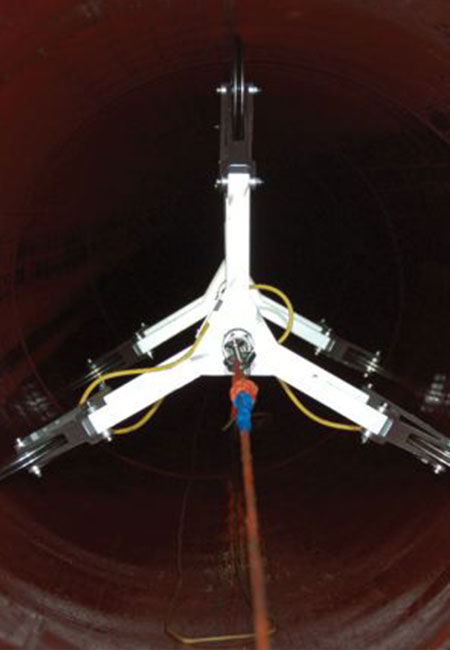
After Horizontal Directional Drilling (HDD), we deploy gyroscopic tools such as the ABM-90 to record as-built pipeline alignment in 3D. GPS coordinates are cross-verified on site, and the resulting data is exported to CAD for precise documentation and compliance.
We compile utility data into a geospatial database using advanced GIS platforms. All gyroscopic and locator data is captured in X, Y, Z coordinates to build a digital underground utility dashboard—essential for future planning, asset management, and engineering reference.
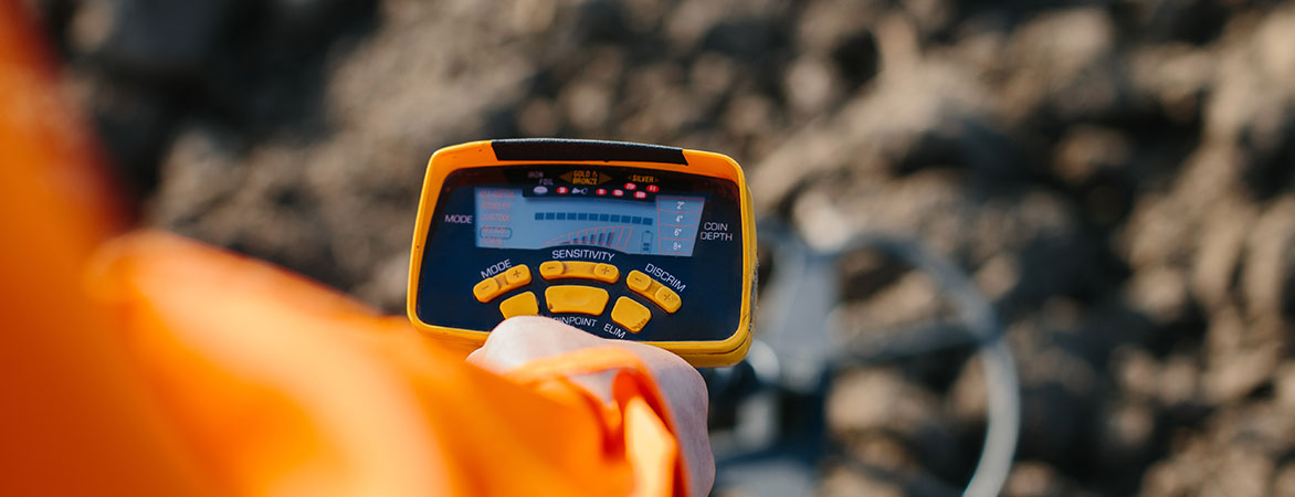
Our experienced team uses Pipe Cable Locators and calibrated instruments to trace the location, depth, and alignment of existing underground cables, pipelines, and conduits. This pre-excavation service reduces the risk of utility strikes and service interruptions.
Accurate underground utility data is critical to safer, faster, and more cost-efficient project execution. At UUE, we combine advanced technology with field expertise to deliver reliable detection and mapping solutions that support every stage of your project.
Avoid costly surprises by identifying buried infrastructure before breaking ground.
Ensure full compliance with utility safety guidelines and local regulations.
Make informed design and construction decisions with precise, verified data.
Enhance communication between planners, engineers, and contractors with shared digital maps and reports.


